Geological mapping is an integral part of the ore mining process. It enables geologists to compare the interpreted geological model with real mapped data of any wall, roof, bench or floor. The interpreted model can then be refined based on this hard data. The Drill & Blast engineers may also use this information as a quick visual tool to assess the rock type and adjust blast parameters if necessary.
Metallurgists can also use the data to adjust processing parameters and feed rates according to rock type and grade. The Geotechnical Engineers can use the mapping to assess wall conditions in different lithologies, defining geotechnical domains, and interpret faulting as mining progresses. This enables them to refine ground support designs.
The below steps outline how to color a DTM by geology in GEOVIA Surpac.
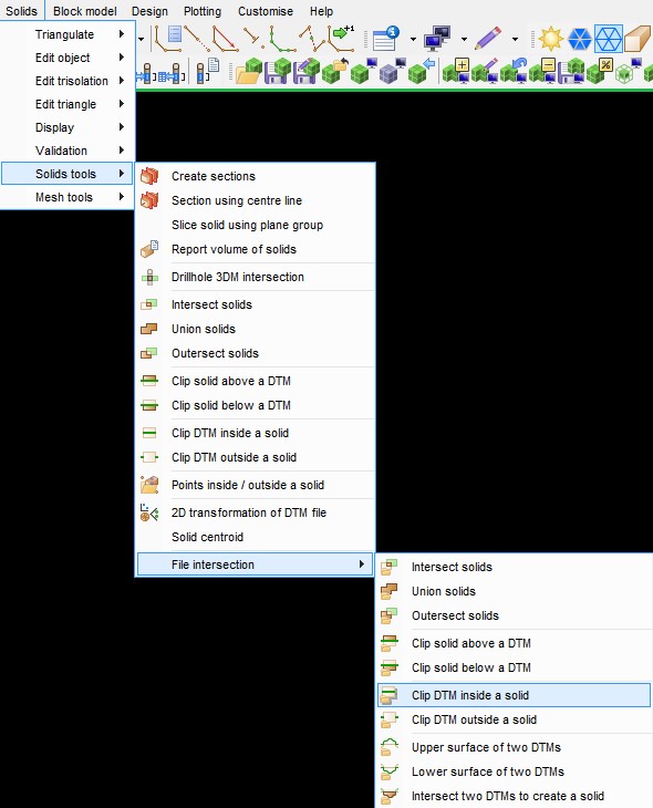
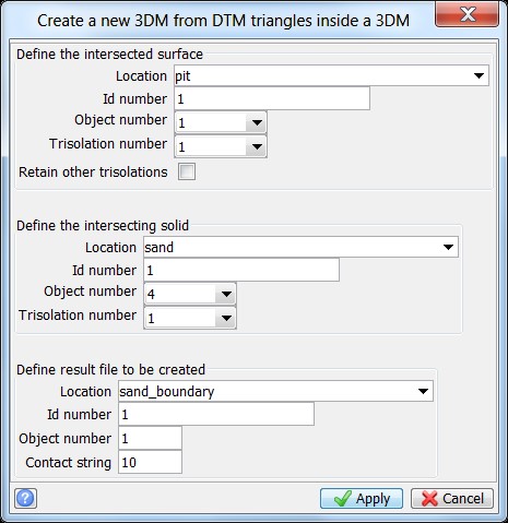
- Firstly, open up Surpac and go to Solids > File Intersections > Clip DTM Inside a Solid.
- The contact strings will be numbered 10. Open up each of the files and delete the unwanted string and renumber to the color for that particular geology code. Ensure that the strings are clockwise and closed.
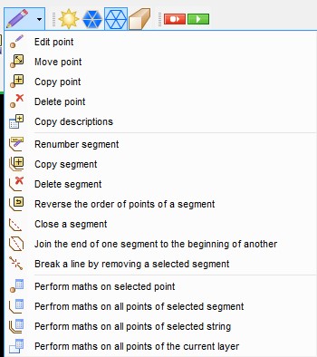
- Open the string into one layer. Using edit > layer > maths… add the geology codes to the corresponding string numbers. Save the file.
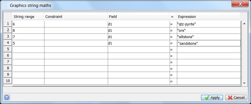
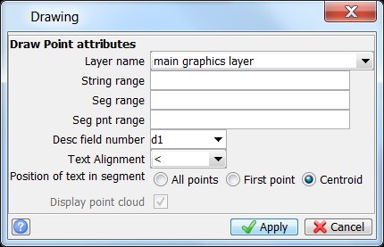
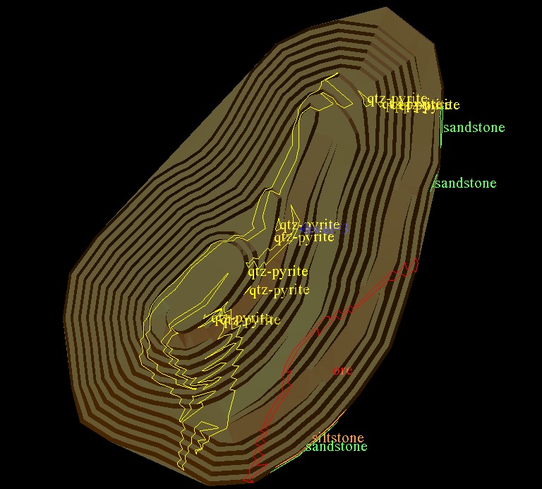
- Display the d1 field in the centroid position and check the descriptions are correct.
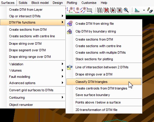
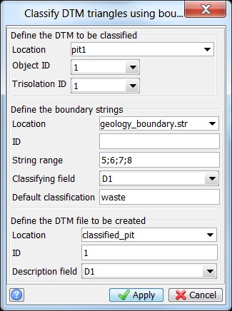
- Go to Surfaces > DTM file functions > classify DTM triangles. Fill in the following form. Remember to make sure the string range matches what is in the form.
- Open the resultant DTM and color.
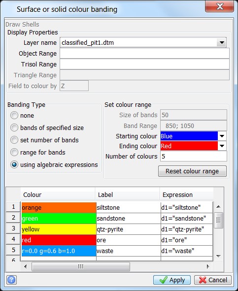
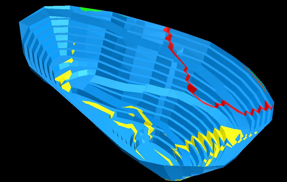
- The DTM will then be coloured by geology (see below example).