
Floods are a multi-dimensional problem
For the past decade, several extreme flooding events across the globe exposed the growing vulnerability of urban systems to climate-driven hydrological extremes. From South Asia, passing through Europe and Africa, to South America, unprecedented rainfall intensity, urban expansion and inadequate adaptation measures have combined to generate severe social, economic, ecological and infrastructural consequences.
According to the United Nations Office for Disaster Risk Reduction (UNDRR), it is reported that floods account for up to 35–40% of weather-related disaster occurrences, with direct losses estimated at over $200 billion annually, not including cascading impacts (1). The Intergovernmental Panel on Climate Change (IPCC) underscores the escalating risks and impacts of flooding due to climate change. In its Sixth Assessment Report (2), the IPCC highlights that extreme precipitation events, including heavy rainfall leading to river and pluvial flooding, are increasing in frequency and intensity across many regions.
In 2025, catastrophic flooding across multiple continents exposed the mounting vulnerabilities of both urban and rural systems to extreme hydrometeorological events: In South Korea, torrential rains submerged nearly 29,448 hectares of farmland – equivalent to some 40,000 soccer fields – and wrought damage on hundreds of public structures, roads and drainage systems (3). And in Argentina’s port city of Bahía Blanca, flash flooding following approximately 260 mm of rainfall in a few hours killed at least 16–17 people, flooded thousands of homes and impacted about 70% of the city’s 340,000 residents (4).
According to the World Health Organization (WHO), floods cause not only injuries and deaths but also long-term health issues, including waterborne diseases and mental health challenges (5). The European Environment Agency (EEA) reports that floods also disrupt ecosystems, destroying habitats, eroding soils and reducing biodiversity, which in turn affects the natural services that support communities (6). These findings show that the consequences of flooding extend beyond buildings and roads, touching human health and the environment alike.
These events illustrate how intertwined multidimensional impacts are becoming under intensifying climate variability—and underscore the urgent need for better management strategies.
What exactly is the flooding phenomenon? Why does it happen?
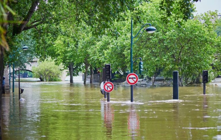
Flooding occurs when water exceeds the capacity of land or drainage systems and it is driven by several major factors: intense or prolonged rainfall, rapid snowmelt, river or dam overflow, urbanization that increases surface runoff, low-lying geography and climate change, which intensifies extreme weather events. Together, these factors make floods increasingly frequent and severe worldwide. When we talk about flooding, it’s easy to imagine it as one big problem – but in reality, floods come in many forms, each with its own causes and challenges. Let’s have a deeper look in the different types and challenges:
- Riverine flooding happens when rivers overflow their banks after heavy rainfall or snowmelt. It’s the classic kind of flooding we see in large river basins and floodplains.
- Flash floods are sudden and fierce – often striking within minutes of intense rain, especially in steep or urban areas where water can’t easily soak into the ground.
- Coastal flooding occurs along shorelines, driven by storm surges, high tides or even tsunamis – and it’s becoming increasingly common as sea levels continue to rise.
- Pluvial flooding (also known as surface water flooding) happens when heavy rain overwhelms drainage systems, causing water to pool in streets, fields and low-lying areas.
- Groundwater flooding is slower and more subtle. It occurs when the water table rises after prolonged wet periods, seeping up through the ground and into basements or low terrain.
- Flooding caused by dam or levee failures is a rare but devastating event that unleashes massive volumes of water with little warning.
Recognizing the different types of floods and the factors that cause them helps us design smarter cities, improve flood dynamics simulations, develop early-warning systems and strengthen communities against future risks. With the right simulation tools, we can plan and respond more effectively to flooding events, minimizing damage and protecting both people and ecosystems.
Using virtual twins to predict and reduce flood-related risks
Using a virtual twin allows planners and emergency services to simulate flooding scenarios with remarkable accuracy. This interactive model shows how water might move – hour by hour – through neighborhoods, identifies weak points in infrastructure and helps in the conception of long-term strategies, such as reinforcing flood defenses, designing smarter evacuation routes and guiding smart, sustainable, urban planning decisions to reduce future risks. By providing a shared, data-driven view for city planners, emergency services and even the public, the virtual twin transforms flood management from reactive crisis control into proactive, coordinated and efficient protection for communities.
At Dassault Systèmes, we offer our clients what we call the feasibility study for flooding management, a solution as a service. In this approach, we create a detailed digital replica of the city – using existing data or from specialized partners – in its current “as-is” state, allowing us to simulate flooding events with precision. Through 3D high resolution simulations, we perform risk, vulnerability and danger assessments, identifying the most fragile communities and areas and potential exposure and hazards. We then provide interactive dashboards and advanced data analytics to support decision-making. Based on these insights, we explore and test mitigation measures, from traditional solutions like flood barriers to nature-based interventions, such as creating retention ponds or modifying land cover to improve water absorption. Our platform allows clients to simulate multiple mitigation scenarios, helping design effective strategies to reduce flood risks and enhance urban resilience.
Final thoughts
In the face of increasing flood risks and growing urban complexity, Virtual Twin Experiences for Infrastructure & Cities technology and detailed flood feasibility studies are becoming indispensable for modern city planning. They allow not only the accurate prediction of flood-prone areas but also the testing of preventive measures such as improved drainage, flood barriers and optimized evacuation routes. These tools, applied across diverse urban contexts, show that effective flood resilience cannot rely on isolated actions but requires coordinated strategies from different stakeholders, where infrastructure, technology and community preparedness work together to create safer, more resilient cities.
For more information, please visit our website: https://www.3ds.com/industries/cities-public-services